Showing all 6 results

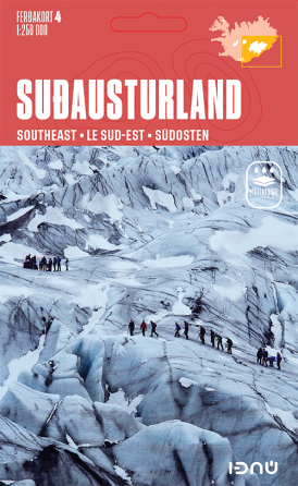
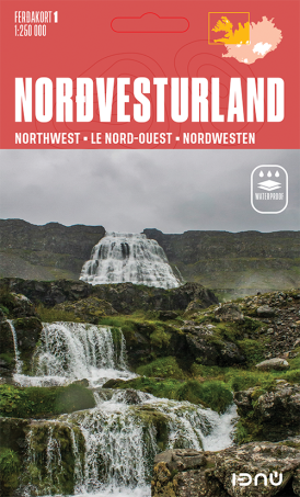
Touring Map 1 – Northwest

 20.00

Quality section map showing the northwest of Iceland. The map has contour lines and shading at 50 m intervals, and contains the latest information about Iceland’s road system and road numbers, as well as important travel-service information such as service stations, swimming pools, museums, protected relics, golf courses and boat trips.
A place name index and distance table are included with the map via a QR code.

The map is printed on tear resistant, waterproof and environmentally friendly paper. This ensures greater longevity and makes the maps more resistant to Iceland’s weather conditions

  • Scale: 1:250 000

  • Published: 2025

  • Size: 70 x 97 cm

  • Languages: Icelandic, English, German and French

  • ISBN: 9789979675471


Touring Map 2 – Southwest

 20.00

Quality section map showing the southwest of Iceland. The map has contour lines and shading at 50 m intervals, and contains the latest information about Iceland’s road system and road numbers, as well as important travel-service information such as service stations, swimming pools, museums, protected relics, golf courses and boat trips.
A place name index and distance table are included with the map via a QR code.

The map is printed on tear resistant, waterproof and environmentally friendly paper. This ensures greater longevity and makes the maps more resistant to Iceland’s weather conditions

  • Scale: 1:250 000

  • Published: 2025

  • Size: 70 x 97

  • Languages: Icelandic, English, German and French

  • ISBN: 9789979675488


Touring Map 3 – Northeast

 20.00

Quality section map showing the northeast of Iceland. The map has contour lines and shading at 50 m intervals, and contains the latest information about Iceland’s road system and road numbers, as well as important travel-service information such as service stations, swimming pools, museums, protected relics, golf courses and boat trips.
A place name index and distance table are included with the map via a QR code.

The map is printed on tear resistant, waterproof and environmentally friendly paper. This ensures greater longevity and makes the maps more resistant to Iceland’s weather conditions

  • Scale: 1:250 000

  • Published: 2025

  • Size: 70 x 97 cm

  • Languages: Icelandic, English, German and French

  • ISBN: 9789979675495


Touring Map 4 – Southeast

 20.00

Quality section map showing the southeast of Iceland. The map has contour lines and shading at 50 m intervals, and contains the latest information about Iceland’s road system and road numbers, as well as important travel-service information such as service stations, swimming pools, museums, protected relics, golf courses and boat trips.
A place name index and distance table are included with the map via a QR code.

The map is printed on tear resistant, waterproof and environmentally friendly paper. This ensures greater longevity and makes the maps more resistant to Iceland’s weather conditions

  • Scale: 1:250 000

  • Published: 2025

  • Size: 70 x 97 cm

  • Languages: Icelandic, English, German and French

  • ISBN: 9789979675501


Touring Map 5 – The Highlands

 20.00

Quality section map showing the highlands of Iceland. The map has contour lines and shading at 50 m intervals, and contains the latest information about Iceland’s road system and road numbers, as well as important travel-service information such as service stations, swimming pools, museums, protected relics, golf courses and boat trips.
A place name index and distance table are included with the map via a QR code.

The map is printed on tear resistant, waterproof and environmentally friendly paper. This ensures greater longevity and makes the maps more resistant to Iceland’s weather conditions

  • Scale: 1:250 000

  • Published: 2025

  • Size: 70 x 97 cm

  • Languages: Icelandic, English, German and French

  • ISBN: 9789979675518


Touring Map Iceland

 22.00

Overall map of Iceland – Place-name index and road distances.
This is a high quality, overall map of the country with contour shading. This map includes the latest information about
Iceland´s road system and road numbers, as well as tourist-service information such as filling stations, swimming pools, museums, etc.
The map comes with a QR code that provides access to a place name index with over 3000 entries and a distance table

  • Scale: 1:500 000

  • Published: 2025

  • Size: 70 x 97 cm

  • Languages: Icelandic, English, German and French

  • ISBN: 9789979675464